A look at how life ebbs and flows on our planet, from space
12/15/2017 / By Rita Winters

As their name defines their work, the National Aeronautics and Space Administration (NASA) monitors space, searching for signs of life on other planets (in other galaxies), and discovers something new about our universe daily. But did you know that this agency also helps scientists understand our own planet? With high-tech satellites that capture images from space, NASA serves as the all-seeing eye in the sky for our scientists who are grounded, literally.
As far as we all know, Earth is the only planet in the universe that accommodates life in all forms. Thanks to NASA’s satellites, scientists are now beginning to understand changes in animal habitats, anticipate disease outbreaks, monitor forests and discover new species of plants and animals. Images from the NASA website show that high-tech cameras in space can track life on Earth over long periods of time, in various locations around the world, showing us changes that we wouldn’t see with our own eyes from the ground. (Related: Will human colonies be on the Moon in five years?)
What can these state-of-the-art technologies do?
- Track the development of phytoplankton – NASA images show green swirls of abundant phytoplankton, single-celled organisms that serve as the powerhouse of the sea. It is produced by water eddies that carry land iron into nitrate-rich waters, which make for a nutritional environment for phytoplankton growth. These abundant sea plants are the basic source of food for marine animals, and also serve as a recycling plant for the massive amounts of carbon dioxide on our planet. Without them, we’d have lethal amounts of CO2 circling our atmosphere.
- Predict cholera bacteria outbreaks – Not only can satellites monitor phytoplankton, it can also follow zooplankton. Cholera, an water-borne infectious disease caused by the bacterium called Vibrio cholerae, can cause water diarrhea, dehydration and death. To avoid infections and deaths from this lethal bacteria, scientists monitor satellite data to analyze the environmental conditions the bacteria thrives in and anticipate possible outbreak locations to minimize its damage.
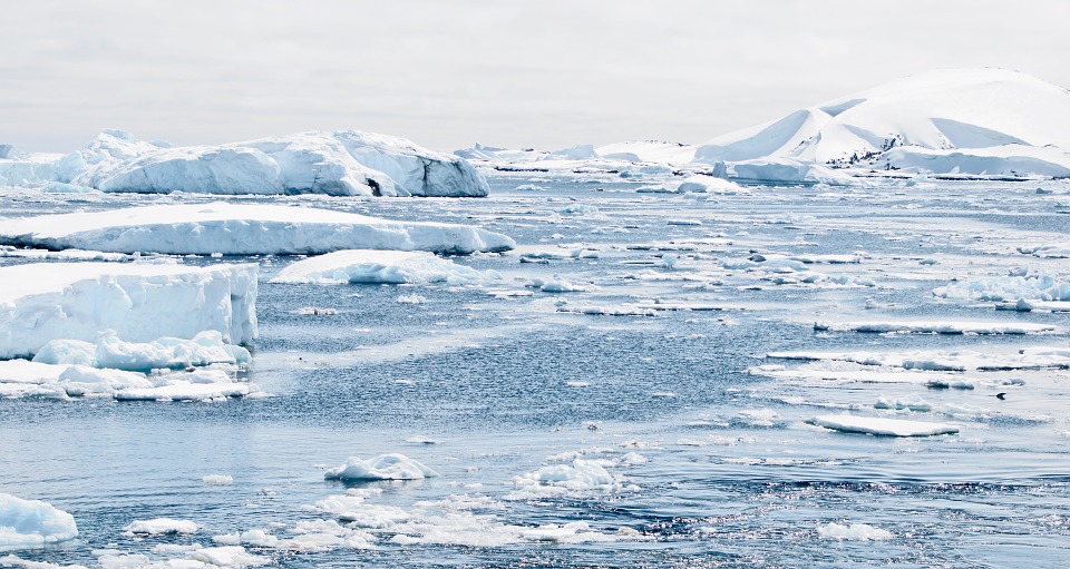
- Monitor bird populations – A few decades ago, the only way to understand bird habits and their activities was to go out and observe them for hours at a time. Because of satellite technology, migratory patterns, potential nests, and populations, are now easily tracked. Satellite imagery is analyzed for guano stains on ice to monitor Antarctica’s emperor penguins. The continent has intense cold weather all-year round, so physical observation is near impossible, especially since emperor penguins prefer to breed in the most remote and coldest places.
- Record a time-lapse of the life cycle of plants – Through pictures from space, we actually get to see Earth’s life forms age over time. Time-lapse over a span of a decade shows how plant life spreads through continents, and how they reduce, as if Earth was actually breathing.
- Keep an eye on our precious coral reefs – Coral reefs serve as homes for many aqueous animals, but large-scale fishing methods destroy them. Corals, like trees, take decades to go into full bloom, which is why destroying them at a fast pace prevents recovery. This is where satellite imagery comes into play – we get to monitor our coral reefs and help maintain them before it’s too late.
- Capture a wonderful view of human life on land – Lights from stars can be seen from Earth, but it is a wonder to see lights on Earth from space as well. Composite images show light-speckled continents during night time, and it might be the most amazing thing you’d ever see from space. Since it’s almost impossible for current generations to get to space, except if you have billions of dollars, we’ll simply have to make do with NASA’s imagery.
The images, as described above, can be found on the NASA website.
Sources include:
Tagged Under: beautiful planet, climate change, Ecology, environment, NASA, Space, space exploration, technology
RECENT NEWS & ARTICLES